Here we will provide various facts about the Map, it's History, it's Zones, and it's Cities and Towns.... and eventually a LOT more about what led to Day Z Sahrani.
BIG THANKS to BeowolfSchaefer for his VERY early efforts in putting together the Sahrani Web Map that is stickied here.
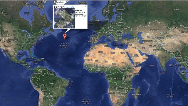
Sahrani is the Fictional Island featured in Bohemia Interactive's Game Armed Assault
The Imgur Album will be updated with even more detailed pictures and descriptions.
We have also now created another Imgur Album with pictures of all the Arma 1 buildings we have added loot positions for (along with a thread here).
Geographical Location: 39° 57' 0" N / 40° 1' 12" W
This is located directly next to the Azores
Landmass/Island Breakdown:
EML Zone - East Main Landmass - ex. Democratic Republic of Sahrani (DRS)
Capital City: Bagango (buh-gang-go) (EML_Z6)
Airfield: Pita Airfield (EML_Z3)
Runway Length: 1100 m Type: Grass
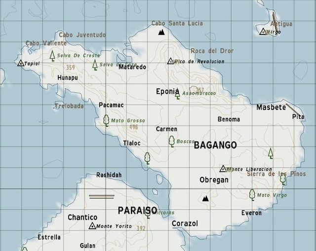
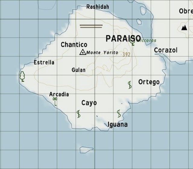
WML Zone - West Main Landmass - Kingdom of South Sahrani (KSS)
Capital City: Paraiso (puh-raise-oh) (WML_Z2)
Airfield: Paraiso-International
Runway Length: 1400 m Type: Concrete
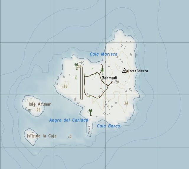
SWI - South West Islands - Rahmadi
Capital City: Rahmadi (Rah-ma-dee)
Airfield: Rahmadi
Runway Type: Grass
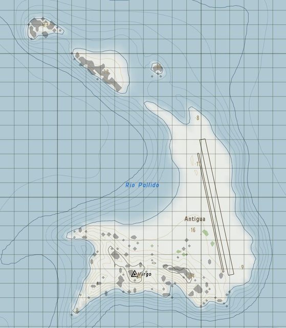
NEI - North East Islands Zone - Antigua
SEI - South West Islands Zone
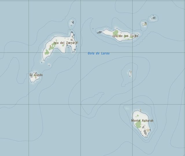
NWI - North West Islands Zone
BIG THANKS to BeowolfSchaefer for his VERY early efforts in putting together the Sahrani Web Map that is stickied here.
Sahrani is the Fictional Island featured in Bohemia Interactive's Game Armed Assault
The Imgur Album will be updated with even more detailed pictures and descriptions.
We have also now created another Imgur Album with pictures of all the Arma 1 buildings we have added loot positions for (along with a thread here).
Geographical Location: 39° 57' 0" N / 40° 1' 12" W
This is located directly next to the Azores
Landmass/Island Breakdown:
EML Zone - East Main Landmass - ex. Democratic Republic of Sahrani (DRS)
Capital City: Bagango (buh-gang-go) (EML_Z6)
Airfield: Pita Airfield (EML_Z3)
Runway Length: 1100 m Type: Grass
WML Zone - West Main Landmass - Kingdom of South Sahrani (KSS)
Capital City: Paraiso (puh-raise-oh) (WML_Z2)
Airfield: Paraiso-International
Runway Length: 1400 m Type: Concrete
SWI - South West Islands - Rahmadi
Capital City: Rahmadi (Rah-ma-dee)
Airfield: Rahmadi
Runway Type: Grass
NEI - North East Islands Zone - Antigua
SEI - South West Islands Zone
NWI - North West Islands Zone